
Urban development plan Groenewoud
Utrecht
The development of the Groenewoud district was made possible by the disappearance of the KWS asphalt plant from the area. Together with the as yet undeveloped land along the Amsterdam-Rhine Canal, this forms a district of 24 hectares for 1200-1500 housing units. The environment is characterized by several paradoxes: a green and quiet area, but directly accessible from one of the busiest highways in our country. A compact infill, bordered by large-scale infrastructure. A framed area that is nevertheless well connected to, and forms a link between, the Utrecht city center and the Leidsche Rijn expansion. A residential area, with an industrial area and the Papendorp office district as neighbors.
Groenewoud owes its name to a farm that has now disappeared. The original polder structure has an east-west parcelization, which, however, only becomes noticeable at a second glance. After all, since its construction in the 1950s, the dominant direction has been determined by the canal. However, the original structure was chosen for the design for several reasons. For example, along the access road, Mercatorlaan, the district is transparent in two directions, where the layout with angled and parallel streets would be too unambiguous. Along Mercatorlaan and along the canal this creates interesting corners and boundaries. The existing height differences, which also run east-west, are efficiently utilized and strengthen the diversity. Through two green-blue zones the district is divided into four subareas, each with a different character: the KWS area (the asphalt plant), Mercator, the Dike and the Pylon. The image quality plan is different for each area. In between there are two lines of sight: a 'central park' and a 'diagonal'. A 16-class elementary school with sports facilities is situated on the diagonal.
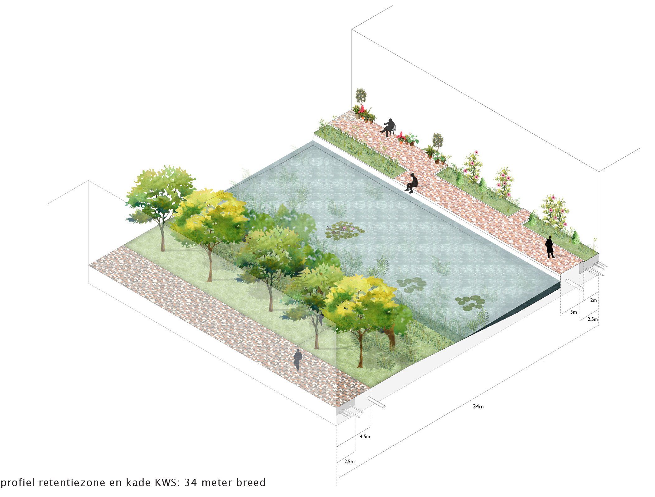
The special character of Groenewoud arises from the combination of the relatively isolated environment, the structure sloping down to the canal, the car-free subareas and the combination of a quiet, green neighbourhood with a high density. The efficient access ensures car-free and car-limited streets. Parking at ground level has been avoided or incorporated into the landscape design. Two wide green areas connect Mercatorlaan with the canal zone. Surface water, retention and rainwater runoff are included in the landscape plan. The characteristic sheds of the asphalt plant will be preserved and will develop from an information center to food halls, business spaces and cultural breeding places. The gravel converter will also be preserved as a rudiment, in the perspective of the two sight axes. The district is sustainable and energy-neutral.
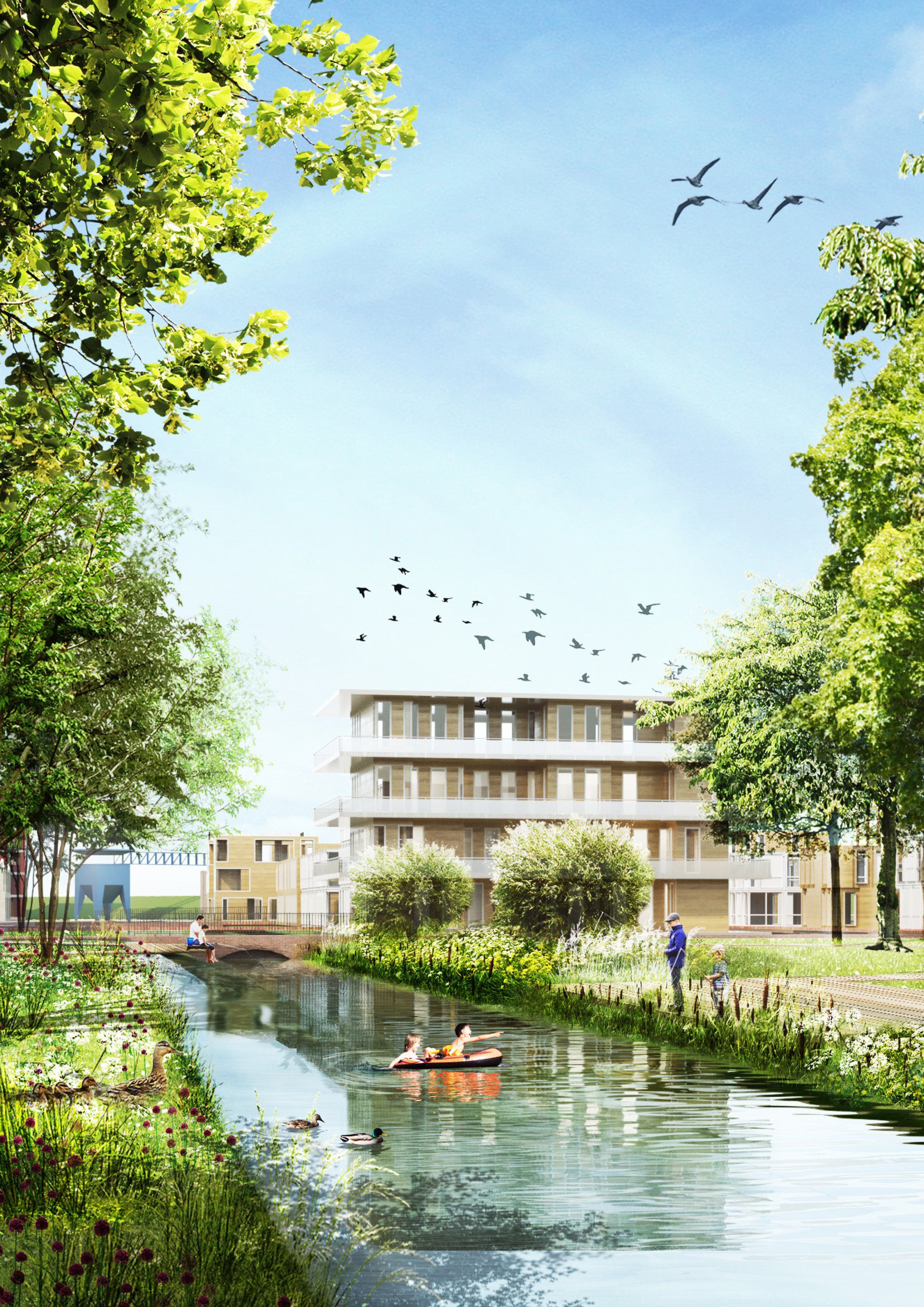
Groenewoud is a special urban district and the final piece of the expansion of Utrecht-West. Spatially, it is a combination of multi-storey apartments and houses with ground-level access. A green enclave, connected to Kanaleneiland and situated on the Amsterdam-Den Bosch (cycling) route. A green-blue district with four different subareas. A high density and yet tranquility.